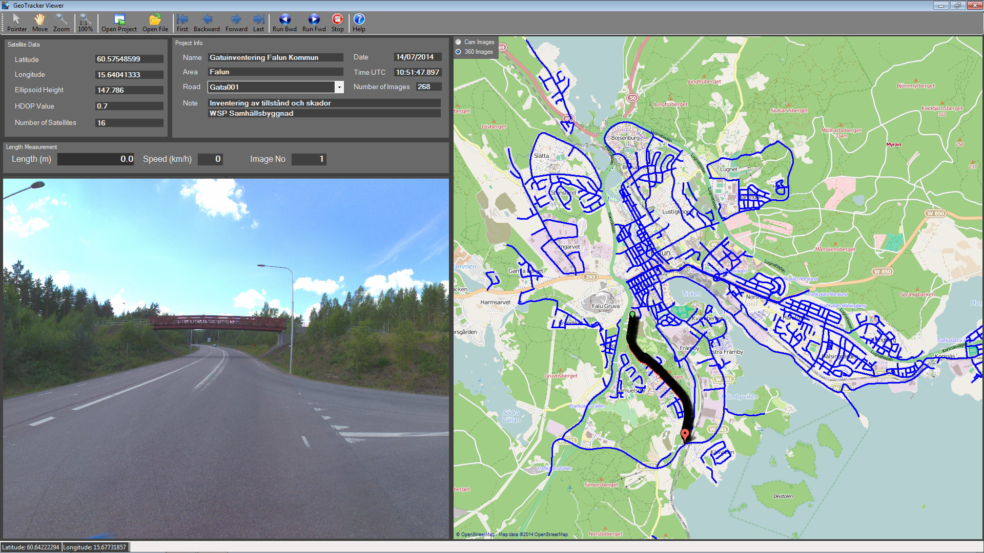
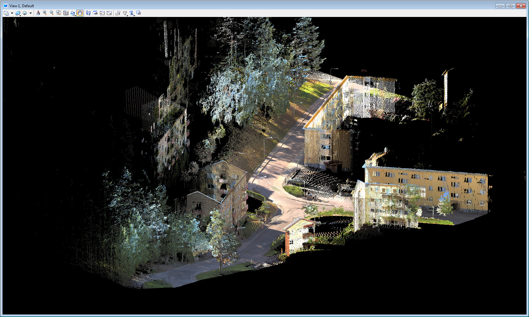
WSP use the GeoTracker system for inventory of complete road networks in many Swedish municipalities. GeoTrackar is built to make everything easy and fast both in the field and at the office. The user can process both panorama images and colored point clouds for a complete project with a few mouse clicks…
Please take a closer look at our image gallery.